Oregon 2005 (4)

landc-1.jpg

7. Seaside

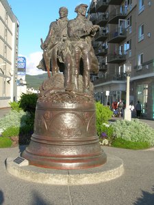
 Friday Sept. 16, 2005. From Astoria I retrace my steps to 101, figuring to make my way down to Florence, where I would turn inland, but not caring how or when I got there. A sign catches my attention, and I turn off toward the sea. At the end of the road is a parking lot and beach access, and I spend a good while on that wide, flat, gritty beach, with its backdrop of dark blue sky and ever-changing, delightful clouds. Across from the lot is a Vacancy sign, and so I spend the afternoon on the beach and the night in a rented condo unit whose windows open up to the sea
Continue reading Oregon 2005 (4)

As the ice retreats

antarcticiceloss.jpg

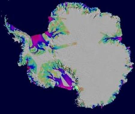
Antarctic ice loss between 1996 and 2006, overlaid on a Moderate Resolution Imaging Spectroradiometer (MODIS) mosaic image of Antarctica. The colors indicate the speed of the ice loss. Purple/red is fast. Green is slow. Image credit: NASA

Antarctica looks to us, on our maps, as one roughly circular continent. Ground-penetrating radar, however, shows it as two parts — to the East, the largest part, an elliptical-shaped mass. To the West, the Palmer peninsula and adjacent territories, actually an archipelago. Between the two, land that is actually below sea level. In other words, the ice conceals the fact that what seems to be one land mass is actually a land mass and adjacent islands.

I’m no scientist, but the map above seems to say that the ocean is reclaiming its own, melting the ice that does not sit on land. What does it say to you?